
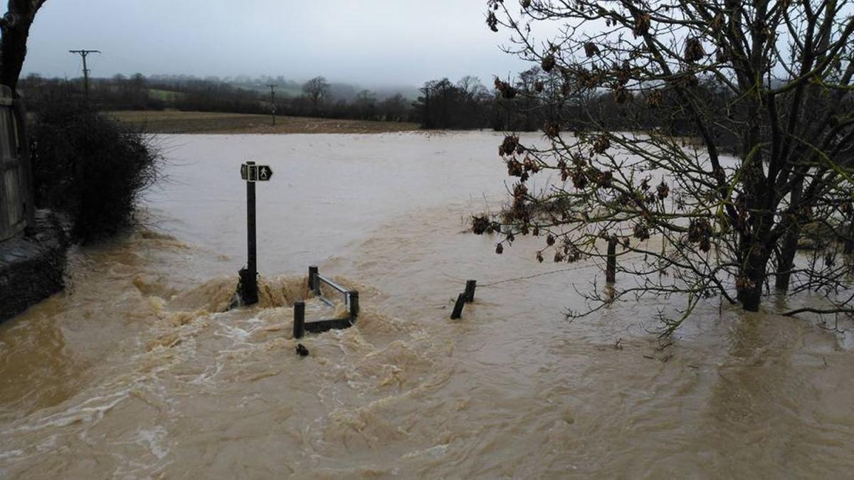

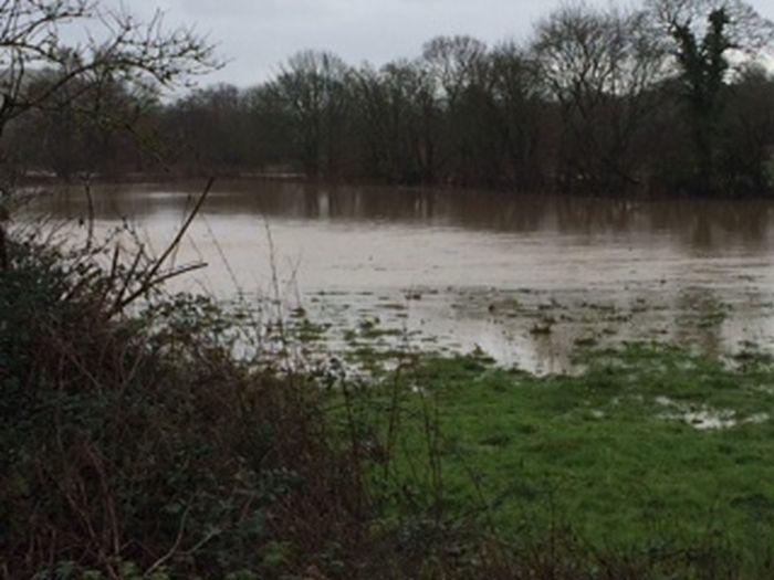
A SITE earmarked for a controversial housing development is likely to ‘flood on a frequent basis’ according to the Environment Agency.
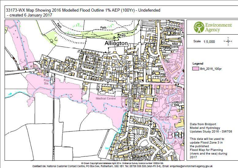
The agency says that although floods happen irregularly and are variable but as there is no significant difference between models for flooding on the Vearse Farm site every 100 and every 1000 years the land will flood frequently.
The agency is objecting to the plans to build up to 760 homes on the site – and will continue to do so unless developers can come up with proposals to stop flooding.
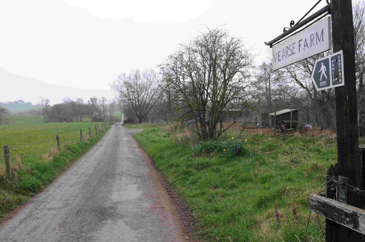
Hallam Land Management has applied for outline planning permission to build up to 760 homes at Vearse Farm on the outskirts of Bridport and close to the banks of the River Simene.
An updated masterplan was due to be submitted to planners last month, but the Environment Agency, which has objected to the developers' initial flood risk assessment, is still waiting to be given assurances from Hallam about the suitability of the site.
A spokesman for the Environment Agency said that Hallam would need to prove the development would not "increase flood risk to the community" in order to secure the public body's approval.
He added: “We currently have an objection to the proposed Vearse Farm development on flood risk grounds and are waiting for the developer to submit an updated flood risk assessment to the local planning authority.
“This updated flood risk assessment will need to demonstrate to the local planning authority that it will not increase flood risk to the community, in accordance with national planning policy.
“This new flood risk assessment will be based on the latest 2016 Environment Agency flood model and the developers have received a copy of the latest information for their use. We will consider the impact of all works within the new modelled floodplain, ensuring it does not increase flood risk to the community.
“Floods happen irregularly and are variable. But in this location there is no significant difference in water level between the [1000 and 100 year] outlines so the land will flood on a frequent basis.”
Campaigners calling for the proposed development to be halted have also raised fears about potential "catastrophic flooding" between Bridport and West Bay.
Members of campaign group, Advearse, have spoken out over flooding fears, and have raised concerns that the latest flood maps, which will be used by Hallam, do not give the full picture of flooding risk.
Advearse says it has evidence the site has flooded as far as the Environment Agency's 100-year limit twice in 2016 and once in 2012.
Barry Bates, who spoke on behalf of Advearse at last week's Bridport Town Council meeting, said the confusion could "lead to a major flooding incident across the town".
He added: "We have high regard for the professionalism of the teams who are working on the flood risk projections. They have a complicated task accounting for the impact of climate change across the whole country. We are grateful they are now updating the risk for Bridport and West Bay.
"Advearse is concerned that if there are errors in the flood maps then the whole exercise may be flawed. Our local concern is the possibility of catastrophic flooding between Bridport and West Bay. We hope there is joined up thinking with regard to flood prevention measures in the Bridport area.”
Andy Birch, regional manager for Hallam, confirmed a consultation will be held on the revised masterplan when the updated application details are submitted.


Comments: Our rules
We want our comments to be a lively and valuable part of our community - a place where readers can debate and engage with the most important local issues. The ability to comment on our stories is a privilege, not a right, however, and that privilege may be withdrawn if it is abused or misused.
Please report any comments that break our rules.
Read the rules hereLast Updated:
Report this comment Cancel