





This pretty and easy Dorset walk winds through an historic country estate.
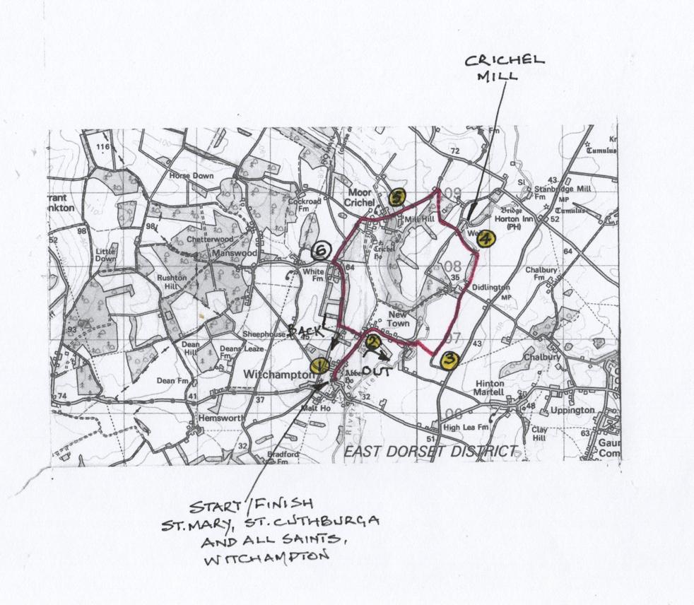
It circumnavigates the grounds and woodland of Crichel House estate and meets both the River Allen and Crichel Stream.
Sir William Napier’s ‘Moor Crichel’ mansion house was burned down in December 1742; subsequently, the central block was rebuilt, and Napier created a huge lake fed by the Crichel Stream alongside Crichel village, which remained for a while.

Sometime before 1770, the villagers were moved to new homes at ‘New Town’ and Humphry Sturt, Napier’s successor, further landscaped the park and enlarged the house around 1777.
The Walk
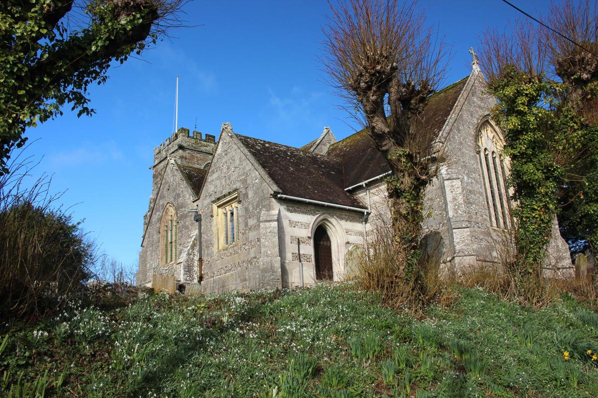
1 From the roadside below St Mary, St Cuthburga and All Saints’ Church, walk up the steps into the churchyard.

Follow the path around the west tower and out through the lych-gate into the road.
Past the left First School and right, Witchampton and Crichel Club and community shop in Ivy House, dating from 1580, with Pound Lane opposite, signed for ‘Manswood’.

Pass the right telephone box and left letter box.
Still straight on, pass left Michaelmas Cottages and more cottages on both sides.
When all cottages end, continue along the road with Allen Valley fields below right and higher fields left.
Then, with rows of trees left.
At the three-way signpost with Lawrence Lane left, keep straight on for ‘Newtown’.
2 At Crichel House’s elegant stone archway gate, a footpath goes through the right gate but continue past right 17th-century cob-walled and thatched Step House and around the right bend.
The trees above house a vocal parliament of rooks, before two left cottages and the Sports Club Play Park entrance.
Continue down the lane with River Allen fields right and larger houses behind the left brick wall and iron-railed fence.
Meander past several cottages through Newtown to a right bend signed ‘Private Witchampton Mill’ only.

Take the left footpath-signed path along the rendered wall above the left stream.
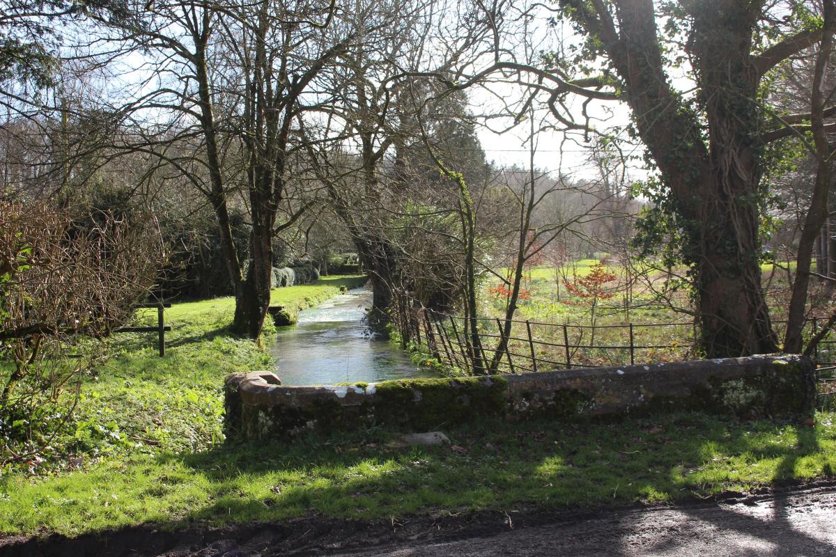
Swing right to the River Allen footbridge with sluice gates, an arched bridge downstream and fine properties either side.
Over, continue along the riverside path with fenced duck pond and trees right.
Bending right, the path leaves the river.
There are now open fields left and woods right.
Right/left over a concrete footbridge, follow the path to the footpath-arrowed kissing-gate.
Through, walk straight on over the long field to the hedge-gap.
3 Through, turn left along the hedged grass track.
In ¾ mile, go straight into the facing wood with a left signed-footpath before Didlington Farm’s wood-fenced left barnyard.
At the facing double gates, go through the gap onto the driveway.
Continue past the left gates and right-turning driveway at ‘Didlington Farmhouse 1743’ mill stone.
Sign-posted for ‘Victoria Cottage’ and ‘Stanbridge’, keep straight on along the drive and past Victoria Cottage to the cantilever-gate.
Through, follow the track along left River Allen as it meanders through Didlington Farm’s grounds.
Then continue along the track between the river’s reed banks left and fields right.
Reaching a T-junction, ahead is ‘Private’ so bend left over the River Allen’s iron-railed bridge.
4 Keep straight on, now with the river in the right trees, and with fields left.
Reaching the facing woods, two branches of the river meet having been divided at Crichel Mill house and cornmill.
The nearest branch appears through the brick house’s mill-race archway which is dated ‘1740’.
As you pass the building, bend left, away from the walled yard and kennels, and walk up to the two-way junction.
Go straight on through the wire fence’s Hardy Way and footpath-arrowed cantilever-gate.
Keep straight on up the wide track between fields to the right wood and bend right around the top corner.
With left field and right wood, pass a left track and continue on the Tarmac drive through stately pines to the exit gate and the road, bridleway-signed back.
At the four-way signpost, turn left for ‘Moor Crichel ¾’.
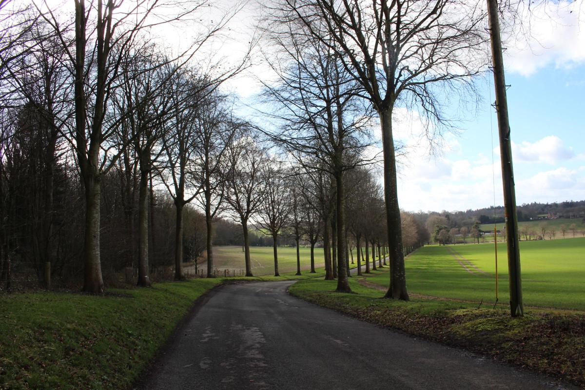
Through the lodge’s old white gate posts, pass left woods and walk down the beautiful beech avenue with long views right along the Crichel Stream valley and with Crichel estate fields and woods left.

The distant glimpse below left is the best view you will get of Crichel House.

5 Continuing down the avenue, pass the right turning for ‘Long Crichel’.
At the avenue’s end, pass the left estate track and the multi-gabled pair of ‘1885 Bena Cottages’.
Cross the Crichel Stream bridge where it arrives from Long Crichel and flows towards Crichel House’s lake.
Keep straight on, rising now, variously hedged and fenced, past cottages, paddocks and yards, and along the high brick and rendered estate Timber Yard wall.
Past the yard’s entrance, continue up to right Northfield House’s drive before the ‘Moor Crichel Timber Yard’ junction.
Bend left for ‘Witchampton 1½’.
Continue between right iron-railed parkland fields and Crichel estate stables over the left hedge.
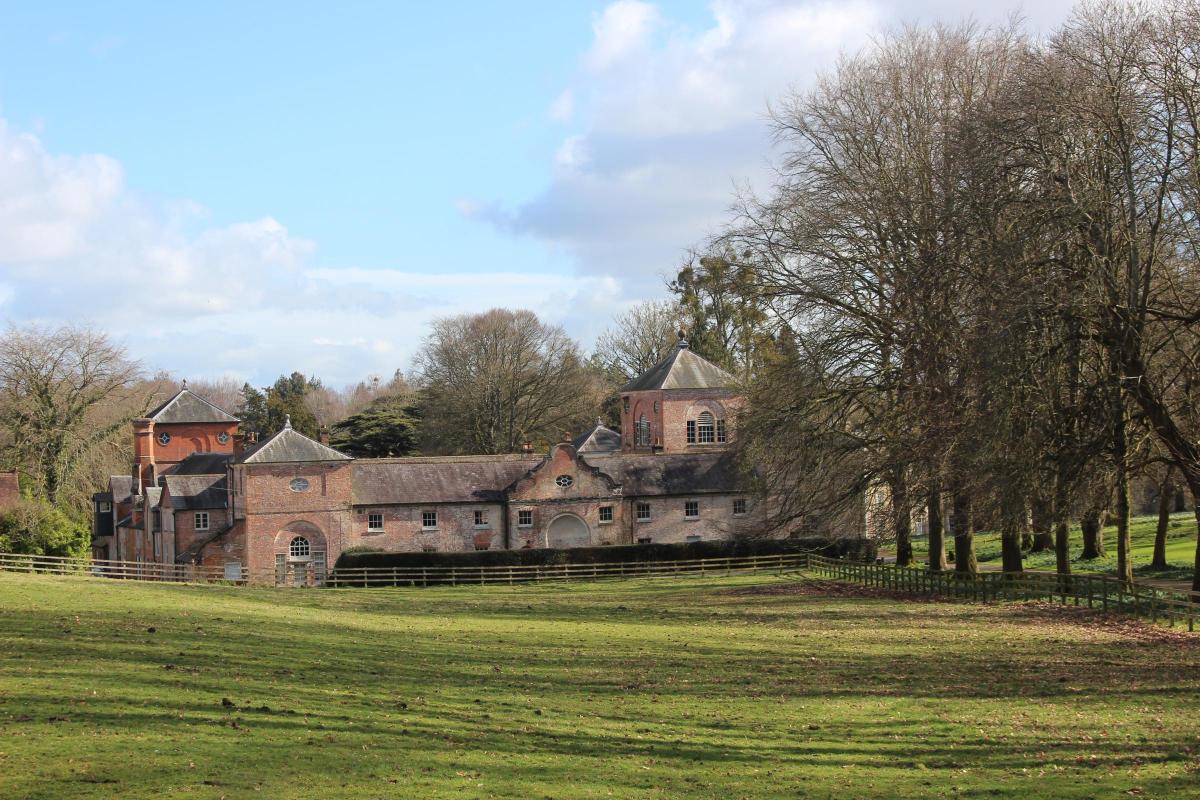
The brick and slate stables were built in the late 18th century with four uniform ranges around a square courtyard, a square tower at each corner and a higher tower above the gateway.
After the left gated drive to Crichel House, continue with laurel hedged woods left and parkland right.
6 In ½ mile, pass the ‘Witchampton’ nameplate and ‘Falconers House’ gates left before the T-junction.
Bend left for ‘Witchampton 1¼’ and keep straight on with wall left and trees right.
Pass right White Farm’s grain store buildings and cottage, then continue, hedged both sides with Crichel estate left and farmland right.
Arriving at the ‘Witchampton ¼’ left turning and ‘Rest and be Thankful’ seat, turn into the lane with estate hedges left and ‘Beeches’ tree-garden right.
Continue down the banked lane and past right Witchampton Garage.
Emerging at the bottom T-junction, with Newtown left and Witchampton right, turn right.
Then walk back above the River Allen fields to Witchampton village and the church where you started.
Compass Points
Distance: 5 miles/8 km
Time: 3 hours
Exertion: Easy.
Mostly on country lanes and farm tracks
Map: OS Landranger Sheet 195
Start: St Mary, St Cuthburga and All Saints’ Church, Witchampton (Grid Ref: ST988064).
Park on road
Public Transport: None
Dogs: On leads on farm tracks and roads.
Abide by The Countryside Code
Refreshments: Village shop has a coffee bar, Witchampton Club open evenings and weekends for food and drink.
Both are in Ivy House.


Share