


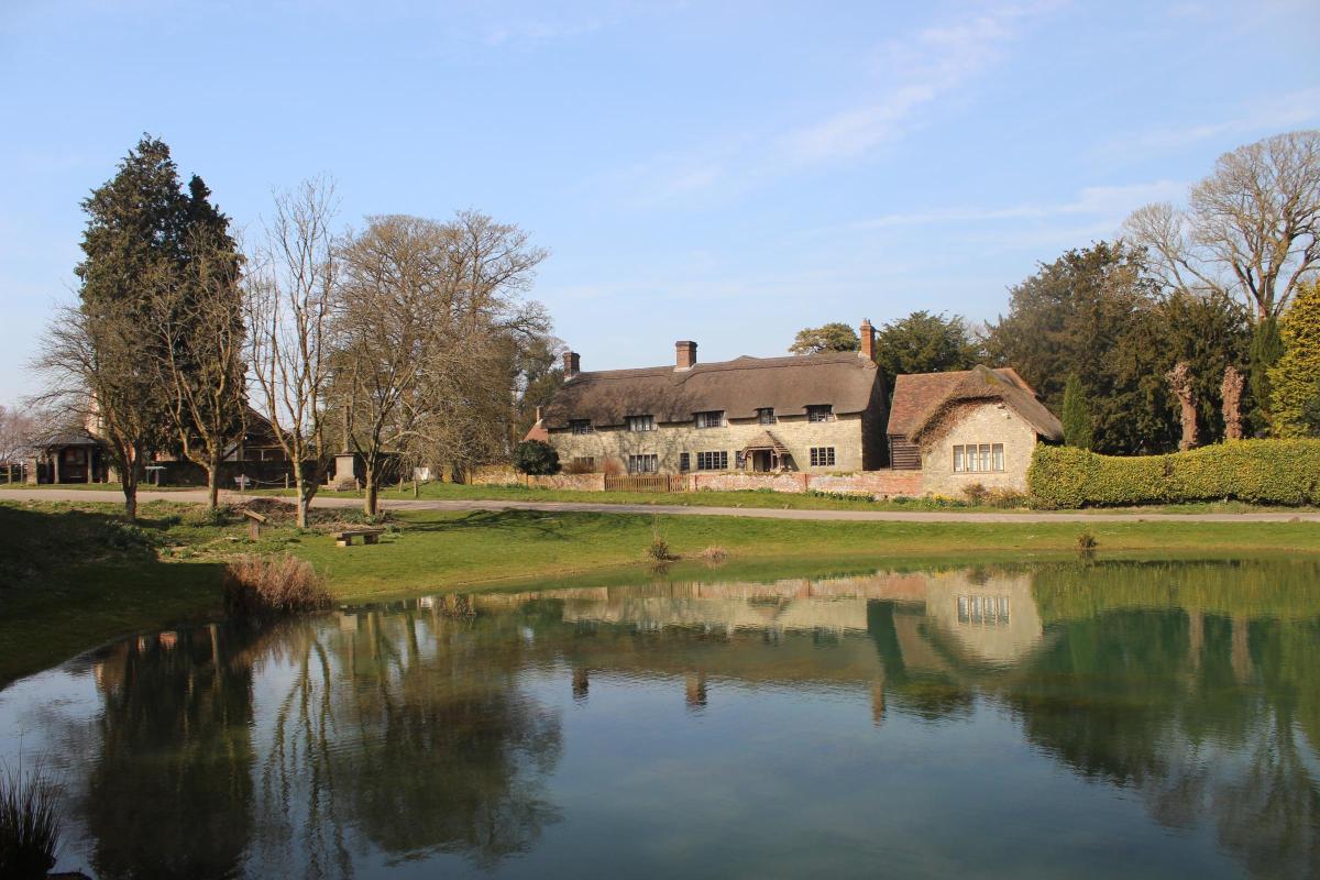

Set 700ft above sea level, Ashmore is Dorset’s highest village - this walk begins in the heart of the village before heading out into rolling countryside and ancient woodland, pairing big-sky views with a real sense of Dorset’s past.
Standing on a high spur between two valleys, 700ft above sea level, Ashmore is the highest village in Dorset.
In his 1981 book Cranborne Chase, historian Desmond Hawkins wrote ‘Ashmore, Tollard Royal, Farnham and Sixpenny Handley display the historical qualities of the Chase heartland more vividly than any others.’
He continues, ‘Ashmore is said to be the only pre-Roman village settlement in Dorset which has survived on its original site.’
Ashmore Wood is about one mile south of the village, set within the Cranborne Chase and West Wiltshire Downs National Landscape. Forestry England, responsible for managing and promoting publicly owned forests in England including this one, offers limited access to it via the network of public rights of way within the woodland.
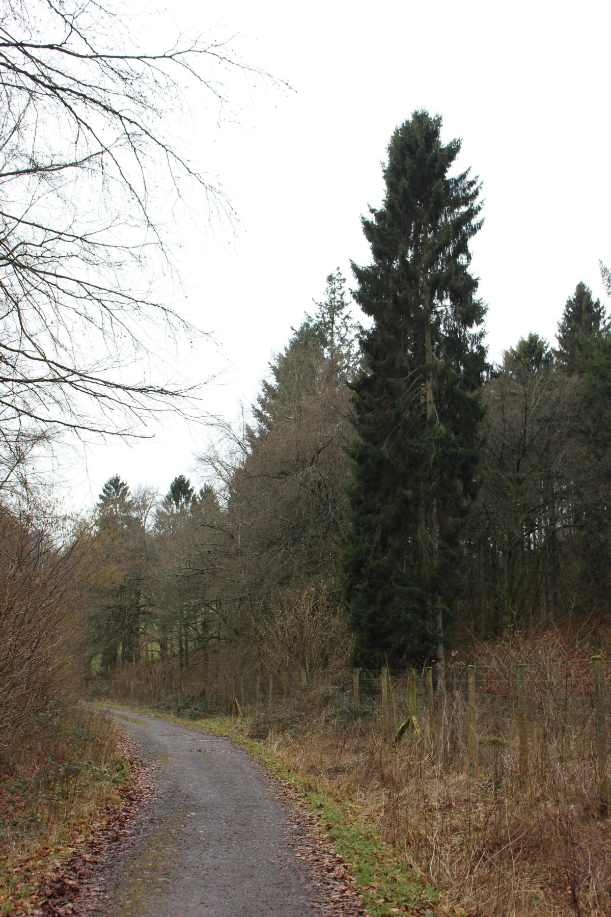
Ashmore Wood is classed as almost completely ‘Ancient Semi-Natural Woodland’ with a small proportion designated as ‘Plantation on Ancient Woodland’. Beech is the predominant species, accounting for approximately 50%. The remaining area is a mixture of conifers, with Douglas fir and Norway spruce accounting for nearly 30%; ash, hazel, Lawson’s cypress and birch comprise the main remaining component species.
Ashmore Wood provides high quality habitat for an array of species including many protected mammals and insects. Historically, nest box schemes have proved successful in establishing populations here which have spread and flourished into the wider woodland.

The Walk
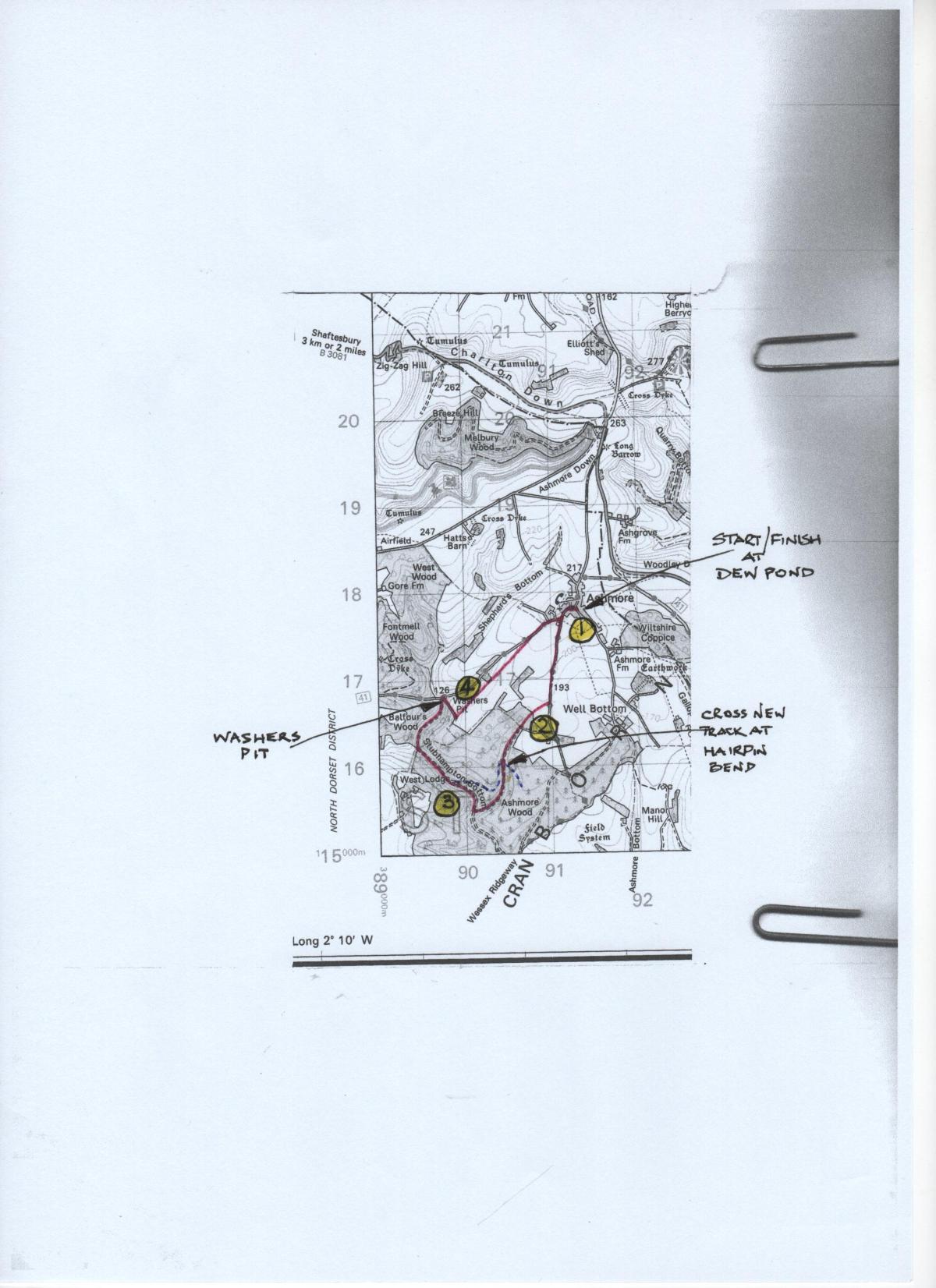
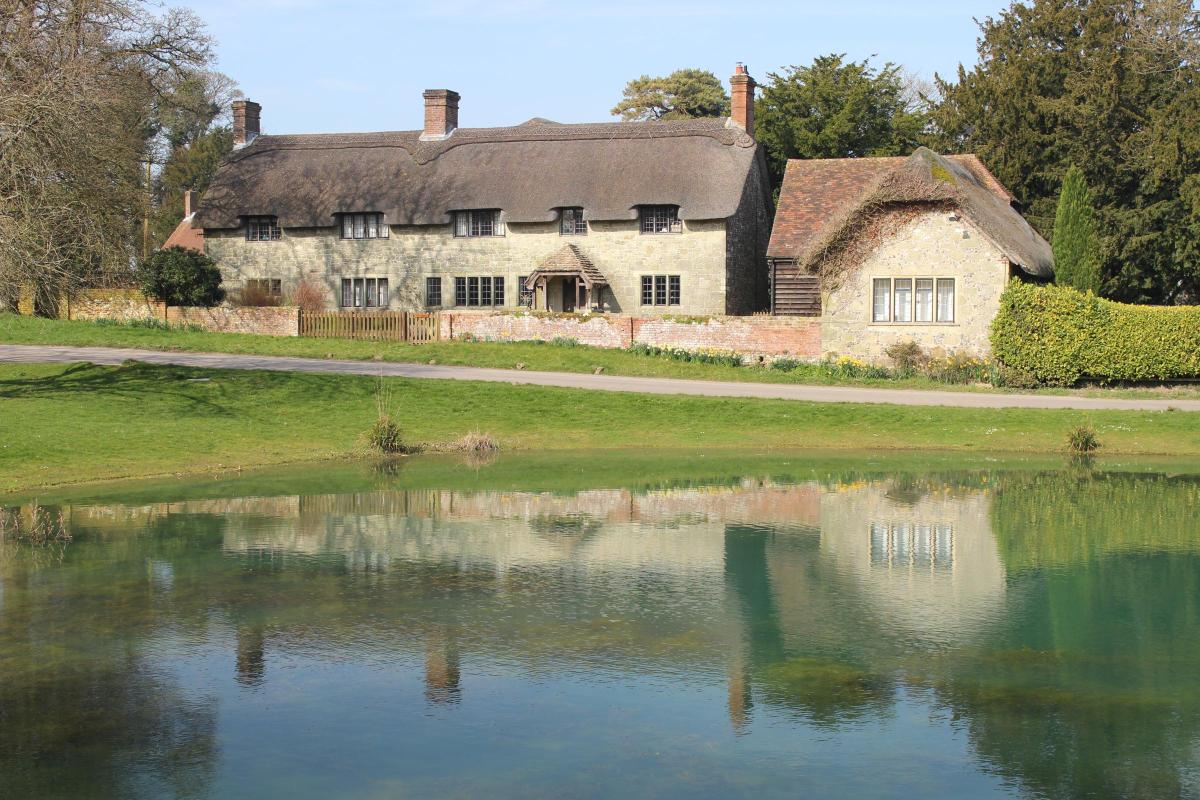
1 From the village dew pond, walk out of Green Lane into High Street. Turn left and, on your right, pass the war memorial, Buddens Lane, the shelter and North Farm House. On the left, notice the Old Parsonage and chapel. Pass the right 1802 thatched cottage and St Nicholas’ Church iron-gates. Along the low right stone-and-flint walls of the field with banked earthworks and Manor Farm House beyond, take the left hedged track (Halfpenny Lane) with the bridleway signpost for ‘Ashmore Wood 1’.
This is part of the Wessex Ridgeway long-distance route. Past the left bridleway-gate, go around the cantilever-gate and walk straight on along the hedged track with long views ahead. Then, with fields both sides, the views are longer and wider, and the track descends slightly. The shallow valley across the left fields leads to Well Bottom.
Past a right track, continue around the right and left curves and past a left cross-field track. In a few yards, take the right footpath-arrowed track with grass up the middle, leaving the Wessex Ridgeway.
2 Diagonally cross this field to the facing wood, with a right track outside. Down into the wood, with cleared edges and newly planted trees, continue to the staggered tracks’ crossing. Go right-left, with a field outside left. Walk down through Great Morris Close wood with groups of hazel bushes.
Reaching a right-slope clearing, there begins a plantation of huge Christmas trees on your right. Pass a rising left track and continue down to a right bridleway-post at a hairpin-bend track. Don’t follow either arm of the track. Instead, cross the bend into the lesser bridleway-track down into the valley’s trees.
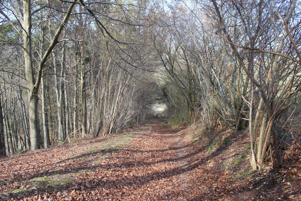
Above, to your right, runs the right arm route of the hairpin-bend track. Keep following the valley track through trees and with wider verges at times, slowly swinging right, down to meet the Stubhampton Bottom bridleway-track.

Turn right, with Spinney Pits Coppice on your left. Slowly swinging through a full 90 degrees, pass a Tarmac track coming down from your right, with a two-way bridleway-post on the left. Now, the left coppice and wood - known as Alington’s.
3 Continue along the valley floor with hazels and pines both sides and rising very slowly. On a right swing, pass a left footpath-gate which opens onto a steeply rising field. The footpath crosses your track and continues up to the right. Keep straight on, now with deer fences left for a while, then with another gate into a rising field. Now with Balfour’s Wood on the left, see the cantilever-gate and cars parked at Washers Pit ahead.

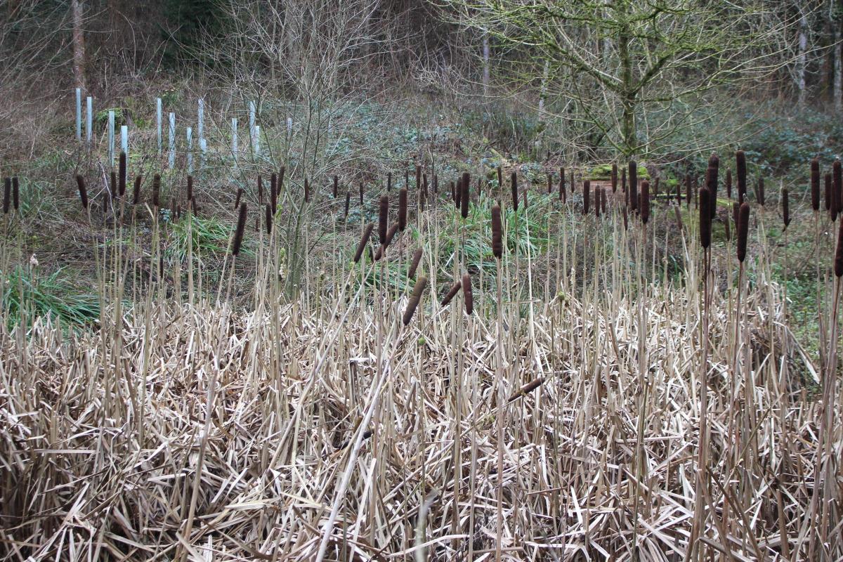
Arriving at the ‘Forestry Commission Ashmore’ car parking area, see Washers Pit Pond packed with bull-rushes over the left fence. Walk towards the car park’s right exit onto the Ashmore to Fontmell Magna road. Don’t leave, but double-back sharp right into the fence-enclosed bridleway-path (probably without an arrow), instantly climbing quite steeply through Washers Pit Coppice above right Stubhampton Bottom. Keep climbing steadily with mostly hazels and beech for nearly ¼ mile until the path bends right. Here, turn off left to the fenced field’s bridleway half-gate.

4 Through into the high field, walk straight on for a mile, rising slowly all the way, with fence and trees right. Instantly, below in the left valley, the track you can see runs into Shepherds Bottom. In the nearer deep valley, which you cannot see yet, is the unseen road from Washers Pit up to Ashmore. Past an old ash tree right, keep straight on near the right fenced trees and into the narrowing section with a left wood. Through the facing bridleway-gate, pass the right sparse clump of ash trees and continue across the field, with the Ashmore road rising in the valley below you. With the field gradually narrowing, still rising, pass some bushes on the sloping hillside and continue to the end 1½ bridleway-signed gates.
Through onto the road, hedged then fenced, continue into ‘Ashmore’. Pass left Manor Farm barnyard’s stone-and-flint wall opposite the similarly walled wood. Keep straight on past Manor Farm Dairy and the footpath-signed track which passes the elegant stone-built Manor Farm House. Continuing along the left earthworks stone-and-flint walls, pass right Halfpenny Lane where you set off into the fields earlier and walk back along High Street to the dew pond where you started.
Compass Points
Distance: 4½ miles/7.25 km
Time: 3 hours
Exertion: Not strenuous, but steep climb from Washers Pit. Some mud after rain
Start: Ashmore dew pond, High Street/Green Lane junction (Grid Ref: ST913178)
Map: OS Landranger Sheet 184
Public Transport: None
Dogs: On leads on farmland, keep to forest tracks. Follow The Countryside Code
Refreshments: None in the village, wealth of options in nearby Shaftesbury including Reeves the Bakers for pies, pasties and rolls


Share