
West Dorset is taking a battering as heavy rain and high winds sweep the county.
A yellow 'be prepared' weather warning for heavy rain is still in force throughout today.
The Met Office warns that this could lead to flooding of some homes and businesses, spray and flooding on roads, delays to bus and train services and some interruption to power supplies.

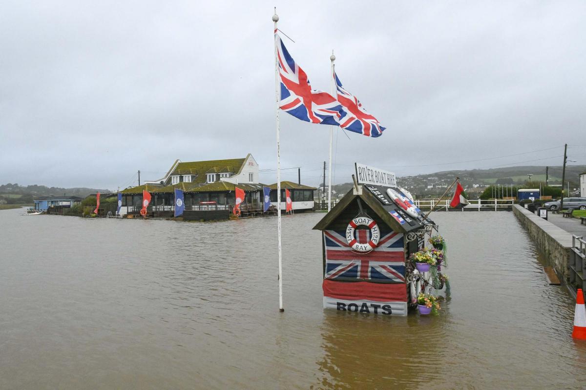
The river Brit bursts its banks at high tide at West Bay with the River Garden restaurant surrounded by floodwater Picture: Graham Hunt Photography

West Bay Picture: Graham Hunt Photography

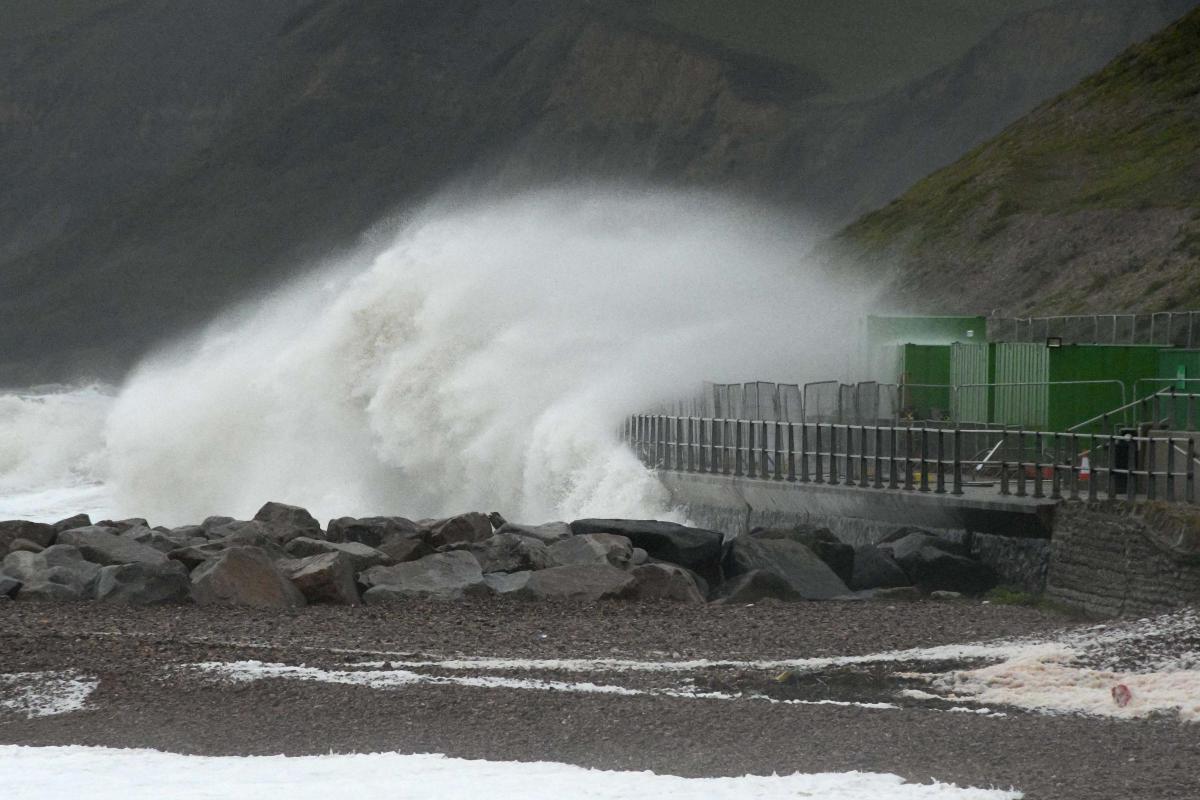
The sea overtops the harbour wall on to the pavement at high tide at West Bay Picture: Graham Hunt Photography
The A3066 Crooked Oak Hill near Netherbury is blocked both ways closed due to fallen tree.
Police advise that a tree surgeon will be attending later on this morning to assist.
A diversion is in place via Crook Hill and Drury Lane which is not suitable for larger vehicles.
Good morning from a very soggy Red watch. We are in for our second day- Its been a busy start for us with a number of alarm calls, fallen trees and escaped animals.
— DWFireControl (@DWFireControl) September 29, 2019
Flood warnings - meaning 'act now' have been issued for Lyme Regis harbour, while flood alerts - meaning 'be prepared' - have been issued for the west Dorset coast and West Bay Harbour.

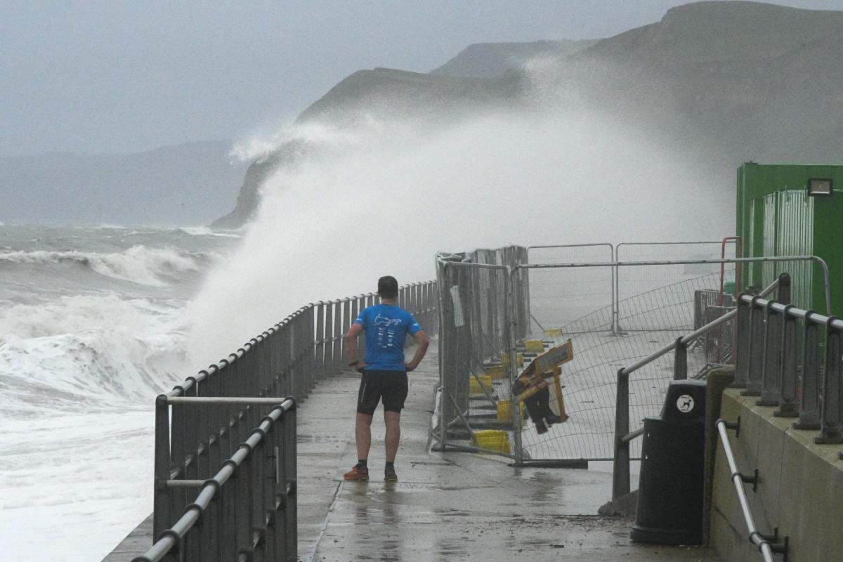
Heavy sea batter the Cobb Harbour at Lyme Regis this morning Picture: Graham Hunt Photography
The Environment Agency states: "Lyme Regis will be affected by large waves and sea spray expected as a result of high spring tides and strong winds. Tides will be at their highest between 5:30am and 09:30am Sunday. Flooding to properties, roads and farmland is possible at these times. We believe there is a possibility of flooding for areas of Lyme Regis around the Harbour. We are closely monitoring the situation. Our incident response staff are checking defences. Please stay away from large waves as they are dangerous."
Regarding the flood alerts, the EA states: "West Bay Harbour will be affected by sea spray and wave action a result of high spring tides and strong winds. The time and date of the first forecast high water is 7:30pm Saturday. Currently, forecast tide level is 2.43 m AOD. The forecast wind strength and direction is Force 6 Southerly. The time and date of the second forecast high water is 8am (Sunday). The forecast tide level is 2.59 m AOD. The forecast wind strength and direction is Force 6 South West. Flooding to properties and roads is possible, and conditions may apply 1 to 2 hours either side of each high tide. We believe there is a possibility of flooding for West Bay Harbour and the tidal stretch of the River Brit. We are closely monitoring the situation and staff are checking defences. Please stay away from large waves as they are dangerous."
A weather warning has been issued for parts of Dorset, for rain, valid 6pm Saturday through 5pm Sunday.
— Travel Dorset (@TravelDorset) September 27, 2019
The towns in the warning area include: Dorchester, Beaminster and Bridport. #dorsetweather pic.twitter.com/6SmpvDLsuP


Comments: Our rules
We want our comments to be a lively and valuable part of our community - a place where readers can debate and engage with the most important local issues. The ability to comment on our stories is a privilege, not a right, however, and that privilege may be withdrawn if it is abused or misused.
Please report any comments that break our rules.
Read the rules here